
Berkeley County Block Sources
Each official source shows a different layer around a Berkeley County address. Parcel maps establish lot relationships. Assessment pages attach dated owner, mailing, physical, legal, and deed-reference fields to a parcel. The voter system supplies election geography and limited registration information under state law. Historical maps and directories describe an earlier block. None is a complete roll of current neighbors.
| Source | What It Shows About a Block | Access |
|---|---|---|
| County GIS and MapWV | Parcel shapes, address fields, legal detail, and assessment links | Free online map browsing |
| Assessor and tax records | Named owner, mailing address, parcel and tax fields | Free portal; office help |
| Polling-place lookup | District, precinct, legislative districts, polling place | Free address search |
| Public voter file | Permitted precinct-list fields, with exclusions and use limits | Clerk inspection or request |
| Library maps and directories | Past buildings, street layout, and selected households | Reservation, microfilm, or archive access |
An owner name can belong to an estate, trust, business, or government body. A mailing address may differ from the physical or situs address, meaning the place where the parcel sits. Even a homestead flag, when present, is only supporting evidence of owner occupancy. Mark every row by source and retrieval date before drawing a conclusion about your neighbors.
Read Berkeley Parcel Fields
The MapWV parcel viewer visibly supports Parcel Address and Flood Zone searches, plus Details, Highlight, Copy Link, and KMZ download controls. Its assessment link can expose a physical street, mailing address, community, E-911 value, district, map, parcel, suffix, legal description, deed book and page, acreage, tax class, land use, and appraisal values. A parcel ID, often shortened to PID, is the map's stable identifier for a tract.
The county sample PID 02-02-011B-0073-0000 is especially useful because it separates these labels. It shows a Berkeley County Council owner, a Martinsburg mailing address, DURBIN ST as the physical field, and a blank E-911 field. It also supplies a deed reference and legal details. That record is a training example about field meanings, not evidence about a private resident.
The official assessment view shows why one “address” cannot stand in for every parcel field.
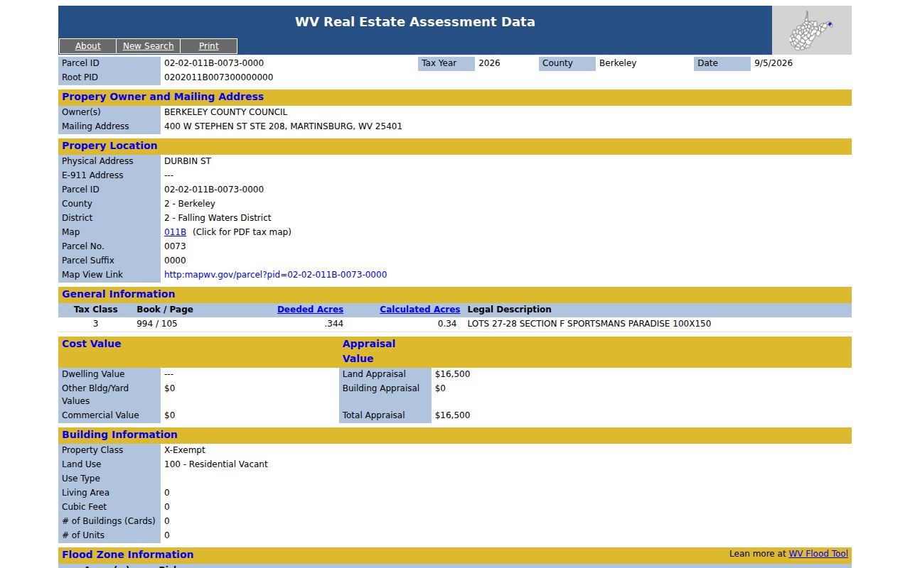
Use those labeled fields when building a block worksheet, and never turn the sample into a claim about who occupies nearby land.
Map a Berkeley County Block
Use the county address lookup or MapWV to locate the target. Browse adjacent mapped parcels one at a time. The unattended review did not confirm a radius export, buffer tool, or named neighbor list, so do not promise those functions. A simple parcel-by-parcel worksheet is more accurate.
- Enter the target address exactly, including the street suffix. Save the parcel link, PID, and retrieval date.
- Inspect each parcel that touches or faces the target. Record map position, physical address, community, and legal subdivision or lot.
- Open the linked assessment record. Copy the visible owner and compare mailing, physical, and E-911 fields without assuming they match.
- Save deed book and page for any parcel that needs deeper ownership research. Mark vacant tracts, rights-of-way, shared drives, and parcel splits separately.
This process maps the immediate block. For a whole road and its full address-record chain, use the Berkeley County street directory. That separation keeps a neighbor inquiry focused on nearby parcels instead of repeating a street-wide search.
Check Berkeley Neighbor Precincts
The Berkeley County polling-place lookup accepts an address and can return its district, precinct, House district, Senate district, and polling place. It is useful for checking whether nearby parcels share current election geography. Boundaries and polling places can change, so date every result and verify it for the relevant election.
The public voter file is a separate route. W.Va. Code §3-2-30 permits inspection of active, inactive, rejected, and canceled files during clerk hours and allows precinct lists in available formats. Public formats can include name, residence address, party, status, and precinct, but exclude telephone, email, Social Security, and driver-license numbers. The law bars solicitation, advertising, sale, and resale uses.
The official polling screen illustrates the address-to-precinct layer used to compare Berkeley County neighbors.
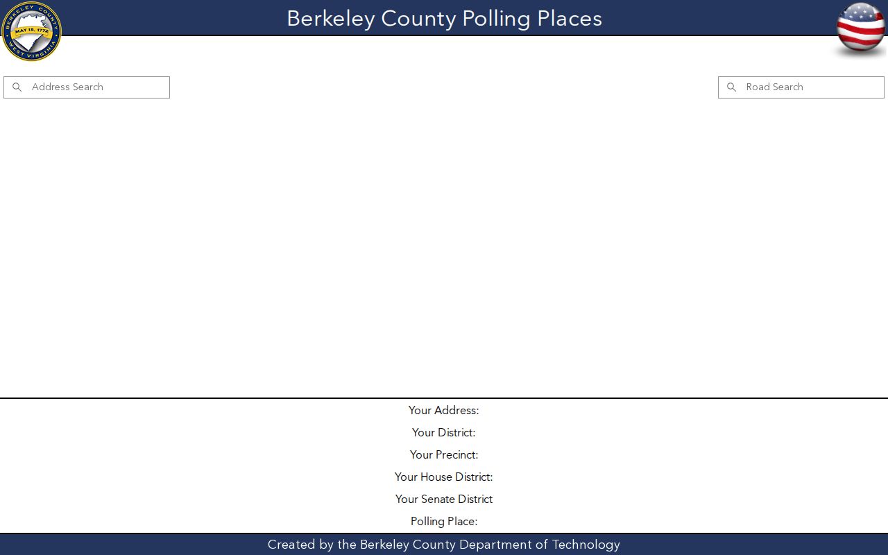
It establishes election geography, not a roster of everyone living on the block.
Note: Ask the Berkeley County elections office for the current noncommercial list procedure, format, scope, and cost before making a request.
Berkeley Community Directory Gaps
No stable official countywide neighborhood-association, HOA umbrella, member directory, or block-watch roster was found in the reviewed sources. Congregation, civic-club, fraternal, and veterans rosters were not verified either. County community lists and planning contacts are geography leads. They are not association membership evidence.
| Community route | What it can establish | What it cannot establish |
|---|---|---|
| County planning contacts | Official filing or planning contact, when public | Every association member or resident |
| Public meeting notices | An organization existed on a stated date | A private household roster |
| Beall Room local history | Neighborhood references, newspapers, obituaries | Current occupancy without corroboration |
| Historical society | Appointment-based community history | Certified present identity |
For local memory, contact the Martinsburg-Berkeley County Public Libraries Beall Room or the Historic Berkeley County Society. Give a street, community, date range, and the type of source needed. Do not scrape or republish a private member list.
Berkeley Neighbors Before Street Numbers
Modern addresses are only the newest layer. The Berkeley County House Tax of 1798 and courthouse survey files can help date a tract before modern numbering. For Martinsburg, the Library of Congress preserves 15 Sanborn fire-insurance sheets from August 1907, while West Virginia University holdings add maps from 1885 through 1913. These maps show structures, uses, and street layout, not resident identity.
Pair the map with a dated directory, deed, tax entry, obituary, or newspaper item. An old directory may be alphabetical, street-based, or criss-cross, meaning arranged by address. Inclusion was irregular, so a missing household is not a negative finding. The library's newspaper microfilm covers Berkeley, Jefferson, and Morgan papers from 1791 to the present and can add events or neighborhood references.
This before-and-after view is a strong way to understand neighbors around a historic block: old tract or legal description, then directory street label, parcel and deed, and finally the current public-safety address.
Compare Berkeley Neighbor Sources
Official rolls and commercial neighbor tools have different origins. County and state systems have a named custodian, stated fields, and a correction path. Commercial tools may combine purchased and public information without showing when each item changed. Use the comparison to judge a lead, not to rank people.
| Feature | Official Berkeley or state source | Commercial category |
|---|---|---|
| Purpose | Parcel, tax, court, election, or archive function | Compiled people and address leads |
| Field meaning | Defined by the custodian | May merge unlike fields |
| Date | Often tied to a tax year, filing, or retrieval date | Freshness may be unclear |
| Correction | Ask the office that keeps the record | Private removal process varies |
A county parcel owner is still not proof of the occupant. Confirm only the fact the official record was made to report.
Request Berkeley Block Records
When an online map or roll does not answer the block question, move to the office that owns the record. The Berkeley County Assessor at 400 W Stephen Street, Suite 106, can explain assessment and parcel fields by phone at 304-264-1904 or in person. Tax records use a separate Sheriff inquiry system. Deeds and recorded instruments belong to the County Clerk in Suite 103, whose office can help by telephone, mail, and at the counter. The clerk's paid Virtual Courthouse offers registered access, but copies and older material may still require direct staff help.
Ask for a precise product. For an adjacent parcel, provide its PID, district, map, parcel, suffix, physical address, legal subdivision or lot, deed book and page, and the date shown by the viewer. For election geography, give the exact address and ask the voter office whether the current precinct list is available for lawful inspection or in a noncommercial format. That keeps a request tied to public block facts instead of seeking a broad list of neighbors.
Historical block work has its own fallback chain. Reserve time in the Beall Room for newspaper microfilm, obituary indexes, maps, tax or census leads, and local directories. Ask West Virginia Archives about county microfilm and map holdings. The Historic Berkeley County Society takes appointment-based inquiries at its research center. If a nonexempt county administrative record is still missing, use the county FOIA intake and describe the record with reasonable detail. FOIA does not open private rosters, protected addresses, or exempt personal data.
Note: Office hours, fees, portal access, and election geography can change, so confirm them with the current custodian before visiting or ordering copies.
Protect Berkeley County Neighbors
Tax and deed rolls miss renters, relatives, guests, and many household members. Voter files do not include every resident. Utility and delivery customer data are not public directories. A map match cannot be turned into a claim that a named person currently lives at that spot.
The West Virginia Address Confidentiality Program gives eligible survivors a substitute address for specified public transactions and mail. An approved victim-service application assistant submits the application, and certification lasts four years. Never attempt to locate the confidential residence behind an ACP address. Ask each custodian how it handles protected records and correction requests.
Lawful use. Berkeley County neighbor research is for lawful block history, civic curiosity, and personal safety. Never use it to watch, harass, intimidate, or expose anyone.
Keep a narrow worksheet with parcel facts, retrieval dates, and source links. Leave exact birth dates, identification numbers, private contact data, victim identities, and unverified allegations out of any shared notes.